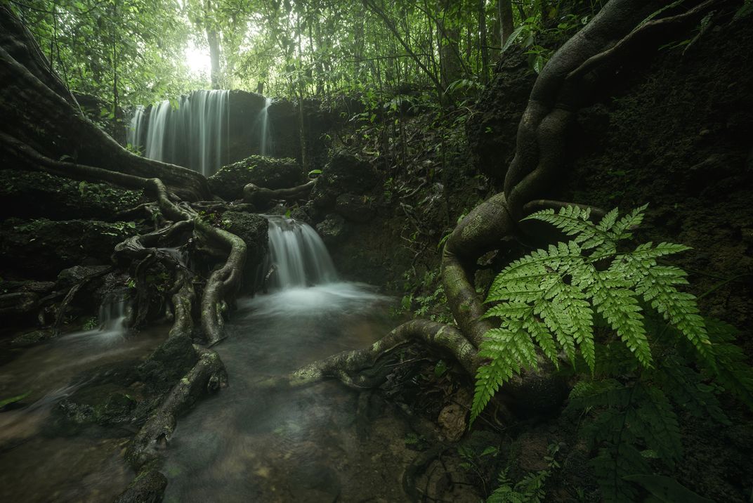
This image was captured in the monsoon of 2019, deep within the rainforest of Agumbe, which is located in Karnataka, a state in the southern part of India. On certain days of monsoon, Agumbe, because of its locational advantage (Western Ghats), receives more rainfall than the wettest place on earth, because of which it is also termed as "Cherrapunjee of South India". It's hilly terrain and constant rainfall has led to the formation of numerous channels that crisscross the forest over rocks, soil, or roots. These channels come alive during the monsoon and some dry up a few hours after the rain stops. This is one such channel that indicates the amount of rain in real-time. One won't see much water here a few hours after the rain stops. Yet one cannot cross it in peak rains.
| Date Taken: | 08.2019 |
| Date Uploaded: | 11.2020 |
| Photo Location: | Agumbe, India |
| Camera: | NIKON D750 |
| Copyright: | © Himadri Bhuyan |