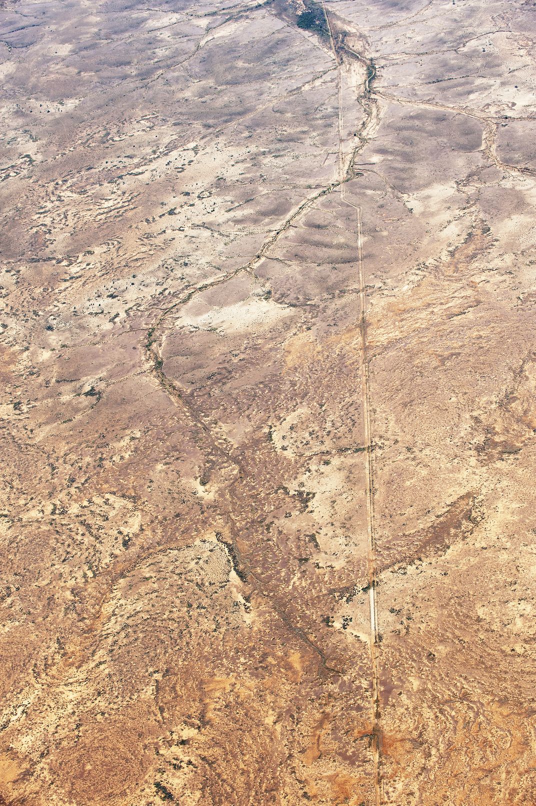
July 9 2021: taken while flying between Wilpena Pound and Lake Eyre in South Australia. The Dingo Barrier Fence pictured runs 5614 kilometres across the heart of the Australian arid zone. It is the straight line pictured, cutting through the landscape. The wire structure is accompanied on both sides by a clearing for a four-wheel drive maintenance track and remains entirely out of bounds to the public, though the fence line can be traversed at various intersection points. Built between 1890 and 1957, the structure presents a worst-case scenario for animal-generated seed dispersal and genetic transfer over the wider region. With climate change, it prevents mobility and access to water essential to survival and adaptation, entirely severing connection between central Australia and the Murray Darling Basin in South Eastern Australia - 77,000 kilometres of interconnected waterways.
| Date Taken: | 07.2021 |
| Date Uploaded: | 08.2021 |
| Photo Location: | Lake Eyre Region, Australia |
| Camera: | NIKON D700 |
| Copyright: | © Justine Mary Philip |